Google Maps added a layer for weather. Just mouse over the satellite box and select “weather” from the list of layers.
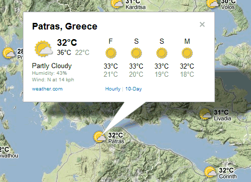
“When zoomed out, you’ll see a map with current weather conditions from U.S. Naval Research Lab. And, if you look closely, you can also tell if it’s day or night around the world by sun and moon icons. Enabling the weather layer also gives you an instant weather report for friends and family living around the world,” informs Google. Weather reports are powered by weather.com and include information about the current conditions (humidity, wind speed, temperature) and a 4-day forecast.
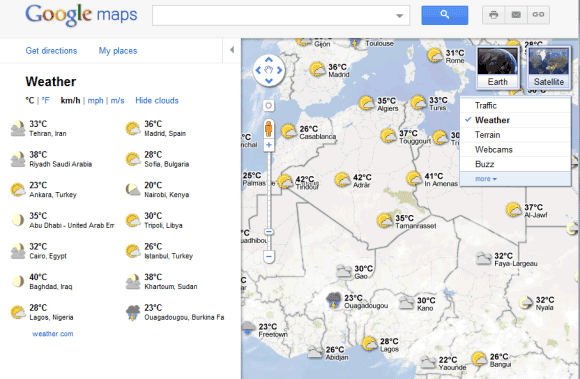
The nice thing about Google Maps layers is that you can combine them. For example, you can enable both the terrain and the weather layers, like you can see in the screenshot above.