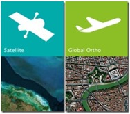
 Bing Maps continues to improve their aerial imagery, announcing today new date provided by TerraColor to present seamless satellite imagery for zoomed out views, new bathymetric (ocean floor) data from Scripps Institute of Oceanography, and new high resolution satellite imagery that now covers 100% of the US and 90% of Western Europe.
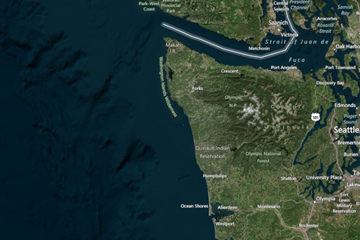
The new base satellite layer, which covers the most zoomed out layers of Bing’s imagery (zoom levels 1-13) not only offers a look under the ocean’s surface (something Google Maps has offered for years, although taking a different approach and showing a more detailed map of the ocean floor), but has improved analysis and processing to reduce cloud cover in areas “notorious for persistent cloud cover such as high latitude and equatorial regions”. Here’s a look at the coast of Washington with the new bathymetric data visible:
 You can read more about Bing’s new imagery, including a number of links to highlighted examples of the impressive imagery on the Bing Maps blog.